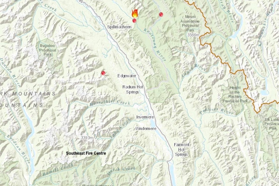
Several new wildfires lit up this past week throughout the Southeast Fire Centre. The largest is the Whitetail Creek fire, estimated at 205 hectares in size as of Tuesday, July 31st. It was discovered Friday, July 27th, and is located in the Beaverfoot valley adjacent to Kootenay National Park, approximately 40 kilometres north of Radium Hot Springs.
According to BC Wildfire Service, the fire, which was lightning-caused, does not currently pose a risk to visitors of Kootenay National Park, or any neighbouring communities or structures. However, area closures are in place, including the Beaverfoot Service Road beyond the 47-km mark, the area near Luxor Pass trail, West Kootenay trail, and Dolly Varden Trail.
Ground crews and heavy equipment are actively working on site, alongside aviation support. By press deadline Tuesday, crews were working to continue building guards to limit the fire’s growth.
There was some concern Monday by Radium business and tourism operators of the fire’s description locating Radium in proximity to the fire, while it is in fact much closer to neighbouring Spillimacheen. In response, Ashley Davidoff, fire information officer, says when naming the location of a fire, they typically use the drainage system or nearby creek, in this case Whitetail Creek. To describe the fire’s location, BC Wildfire Service uses the closest landmark meaningful to a local resident, in this instance Kootenay National Park, and also the closest provincially-recognizable city or village so anyone in B.C. can understand quickly where the fire is.
“We choose a larger centre to reference because it creates a better awareness of the actual location,” Ms. Davidoff reports. “We do have an obligation to be responsible in locating where the fire is in B.C … we have to be transparent about it.”
A wildfire was discovered near Blue Lake, west of Canal Flats Monday, July 30th. The fire is estimated at 17.5 hectares in size. Nearby Columbia Outdoor School at Blue Lake is not being threatened by the fire, reports Ms. Davidoff. Skimmers were on site and ground crews supporting as of July 31st.
Also on Monday there was a miniature 0.01 hectare fire at Bruce Creek, east of Invermere, a 0.01 hectare fire at Thunder Creek east of Canal Flats, and another close to Whitetail at 0.01 as well. A 0.6 hectare fire cropped up at Akenside Creek west of Edgewater. There was also a new fire spotted at Vermilion Crossing in Kootenay National park, at 2.10 hectares. Highway 93 through Kootenay National Park faced shut-downs this week due to fire activity, from Radium to the Alberta border. Several other minor wildfires ignited and were quickly put out in the last week.
Environment Canada issued an air quality alert for the East Kootenay this week due to wildfire smoke. They warned that people with pre-existing health conditions, the elderly, infants, children, and sensitive individuals, are more likely to experience health effects. They recommend staying inside if you have breathing difficulties.