Drought conditions are set to continue, with warm weather returning this week for the East Kootenay.
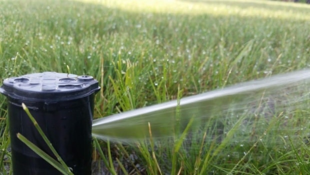
While Cranbrook and area received 6.6 mm of rain over the weekend, which has made conditions better, the precipitation numbers are far below normal.
Matt MacDonald, Environment Canada meteorologist, said that compared to some parts of the province, the East Kootenay isn’t in too bad of shape. So far this month, the airport in Cranbrook has reported 27 mm of precipitation, compared to the normal of 38.3.
“So you aren’t fairing too bad,” MacDonald said. “Droughts are the kind of that kind of develops over the period of several months and not just a few weeks of dry weather.”
He noted that May and June were both below the normal as well. This year there was 46 mm of rain in June, compared to the normal of 62 mm. In May, there was 25 mm of rain, compared to the normal of 44 mm.
“If we tally up the last three months worth of rains, Cranbrook has reported 97 mm,” he said. “Over that three-month period, the normal is 44 mm. So we’re still sitting at about 67 per cent of normal over the last three months.”
MacDonald noted that it is certainly quite dry out. The drought levels are determined by the River Forecast Centre. The East Kootenay region is sitting at Level 2 - Dry, out of four levels.
MacDonald said the Okanagan, the Lower Mainland, and Vancouver Island are in much worse shape.
“It’s been drier for the entire southern half of the province,” he said. “The Kootenays — it’s dry, but it could be worse, I would say.”
He said a trough that had remained over the south eastern portion of the province was set to leave Monday night, but he expected it will only bring about 2 mm of rain.
“The outlook for the entire week is pretty much dry and sunny,” he said. “We’re going to be getting back into those high temperatures. Thursday we’re looking at a high of 33, Friday 35, and then in the low 30s for the weekend. So dry and hot to end the month here.”
MacDonald said there are a number of factors that are causing the drought. One of them is the sea surface temperature off the coast of B.C. The system has been nicknamed the Blob by climatologists. It is a 1,000 km by 1,000 km — and 100 metres deep — mass of warm water which is three to four degrees warmer than normal.
“Because all of our weather comes in from the west, this warmer than normal water is acting to warm the air masses as they come on land,” he said. “So that’s producing higher than normal temperatures, but it is also modifying the overall pressure patterns, so we’ve seen higher pressure throughout the summer and even from the past spring.”
That higher pressure area is deflecting much of the incoming moisture further north or south. He said that has made getting moisture more difficult in the south end of the province.
He said the Blob is an anomaly.
“It is the warmest that area of water has been in the past 1,500 years,” he said. “So it’s quite significant.”
He said the Blob began to develop in the fall of 2013. That was followed by two winters that were mild for storms.
“The storms act to mix the water and as the winds and the waves mix the water, the heat gets dispersed evenly, but with the lack of storms they’re just hasn’t been as much mixing and there hasn’t been the type of upwelling that replenishes the surface with the cold and nutrient rich waters from below,” he said. ‘So with the quiet winters, that water has been able to remain somewhat stagnant and gradually increase in temperature.”
He noted that it took a long time for the huge amount of water off the coast to heat up, but once it is heated it will remain so for a good amount of time.
“The ongoing long-term predictions are for these continued warmer than normal conditions, and beyond that as we head into the fall, and even the winter, El Niño — which is the sea surface temperatures down by the equator — has been continuously strengthening all through the summer.”
While El Niño doesn’t have much of an effect on B.C. over the summer, it plays a more and more significant role as we head in to the fall and winter.
“With this strong El Niño forecasted by all climate models, there’s really good confidence in regards to this, we can expect another winter similar to the last unfortunately — for the snow enthusiasts amongst us. It’s going to be warmer than usual and dryer than usual.”
He also noted the important role that the snowpack plays in the province during the runoff in the spring and in filling up our water reservoirs. He said another winter like the last one would be a challenging one from a water resource point of view.
“This spring there simply wasn’t all that much snow to melt off, because the freezing levels were so high last year,” he said.
MacDonald said the question often comes to climate change.
“My answer to that is it’s hard to peg one summer’s worth of weather on climate change, but I think this is a hint at what climate change may have in store, or what’s to come,” he said.
Also on Monday, the Government of B.C. announced a Level 4 drought rating for the South Thompson, Similkameen, Kettle and Skagit areas due to ongoing low stream flows.
At Level 4, conditions are extremely dry. Further declines in stream, lake and aquifer levels could lead to water shortages and affect people, industry such as agriculture, wildlife, and fish stocks. All water users, including those who access groundwater, are urged to maximize their water conservation efforts.
The establishment of a Level 4 drought advisory, signals that regional water managers may take additional regulatory actions if they are deemed necessary.