The final hot spot for flooding after record rainfall at the end of June, Wasa Lake is slowly but surely on the decline from flood level.
The water continues to drop at a rate of about one inch every 24 hours, a relief for nearly a dozen homes that were impacted by the flood last week.
Over the Canada Day weekend, the Regional District of East Kootenay was asking people not to use boats on the lake to alleviate further flooding impacts for affected homes.
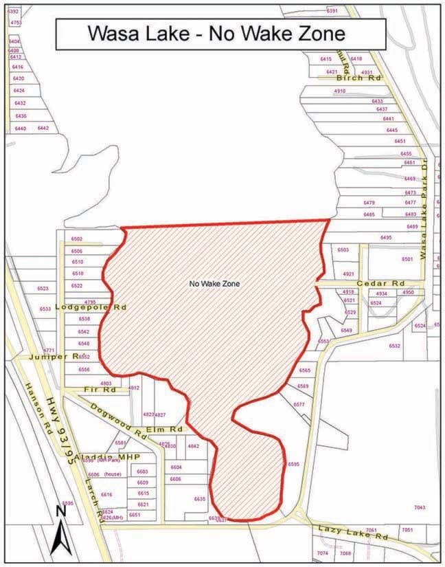
On Thursday, July 4, that request was downgraded to a no-wake zone on the southern half of the lake, where the most affected homes are.
The zone applies to the area below 200 metres north of the Cedar Road boat launch on the east side of the lake, and below the north end of Larch Road where it meets Wasa Lake Park, 250 metres north of Lodgepole Road on the west side of the lake.
“As the water is still high at Cedar Road, we are requesting people not use the Cedar Road launch and choose an alternate launch at this time,” said RDEK information officer Loree Duczek.
“Thank you for your patience during the voluntary ‘no boating’ request, and in advance for respecting the requested no wake zone during the continued high water.”
To ensure boat wakes don’t cause further flooding for affected homes, the RDEK is asking boaters to voluntarily reduce speeds in the no-wake zone.