Due to wildfire damage in areas of the Thompson Okanagan and the Kootenays, the province of B.C. has decided to close an array of backroads in an effort to aid in wildlife recovery.
The Ministry of Forests, Lands, Natural Resource Operations and Rural Development (FLNRORD) announced Friday (October 22) that areas of the Thompsan Okanagan and Kootenays will see 15 new motor vehicle closures under the Motor Vehicle Prohibition Regulation of the Wildlife Act.
FLNRORD says that the closures affect backcountry roads across approximately 536,000 hectares.
The closures are intended to help aid in wildlife recovery and will remain in place for an undetermined amount of time.
The closures were put in place to allow recovery time for wildfire impact on habitats. The ministry also cited the following concerns: erosion of charred soils and impacts to fish habitat; increased vulnerability of wildlife due to migration disruptions, habitat loss and improved sight lines for hunting where vegetation was burned; increased access to wildlife habitat due to the construction of approximately 2,900 kilometres of fire guards.
The Ministry adds that these closures don’t affect community residents or access for commercial vehicles, other than hunting.
“Some exceptions to these prohibitions will be provided to ensure that through-fares remain open and access to private property is not affected,” the Ministry said.
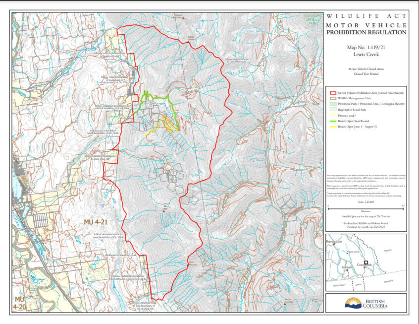
There is a closure surrounding the entire Bill Nye fire area, which affects backcountry roads from Lakit Creek up to Mount Stephens and Lazy Lake.
The closures in the Thompson Okanagan region affect the following areas: White Rock Lake, Lytton Creek/George Road, July Mountain, Mowhokam Creek, Mckay Creek, Tremont Creek, Sparks Lake, Two Mile Road, Hunakwa Lake, Momich Lake, Underdown Creek, Thomas Creek, Garrison Lake and Bunting Road.
For a map of all the closure areas, visit the FLNRORD website, and click on the maps under the heading ‘motor vehicle prohibitions related to wildfires’.
The motor vehicle closure applies to all motorized vehicles including automobiles, trucks, motorcycles, motorhomes, electric bikes, and all types of off-road recreational vehicles, wheeled or tracked, including snowmobiles.
The closures affect all forest service roads in the mapped areas, with the exception of those identified in green. The motor-vehicle closure also applies to all recreation trails and trail networks.
According to the Ministry, hunting is permitted within motor-vehicle closure areas. Motor-vehicle closures can be accessed by non-motorized means for any recreational purpose (e.g., on foot, horseback or bicycle).
“As this area is sensitive to disturbance, people who need to go into the area are asked to stay on existing roads and trails to minimize any disturbance,” says the Ministry.
For more information, visit the Frequently Asked Questions section of the Ministry’s release.
corey.bullock@cranbrooktownsman.com
Like us on Facebook and follow us on Twitter
Want to support local journalism during the pandemic? Make a donation here.