The BC Wildfire Service has provided the latest information on the fire situation in the Cranbrook and Invermere fire zones.
Since August 11, there have been 85 new starts in the Southeast Fire Centre, 16 of which are in the Invermere and Cranbrook zones.
The BC Wildfire Service is prioritizing these new fires and responding accordingly.
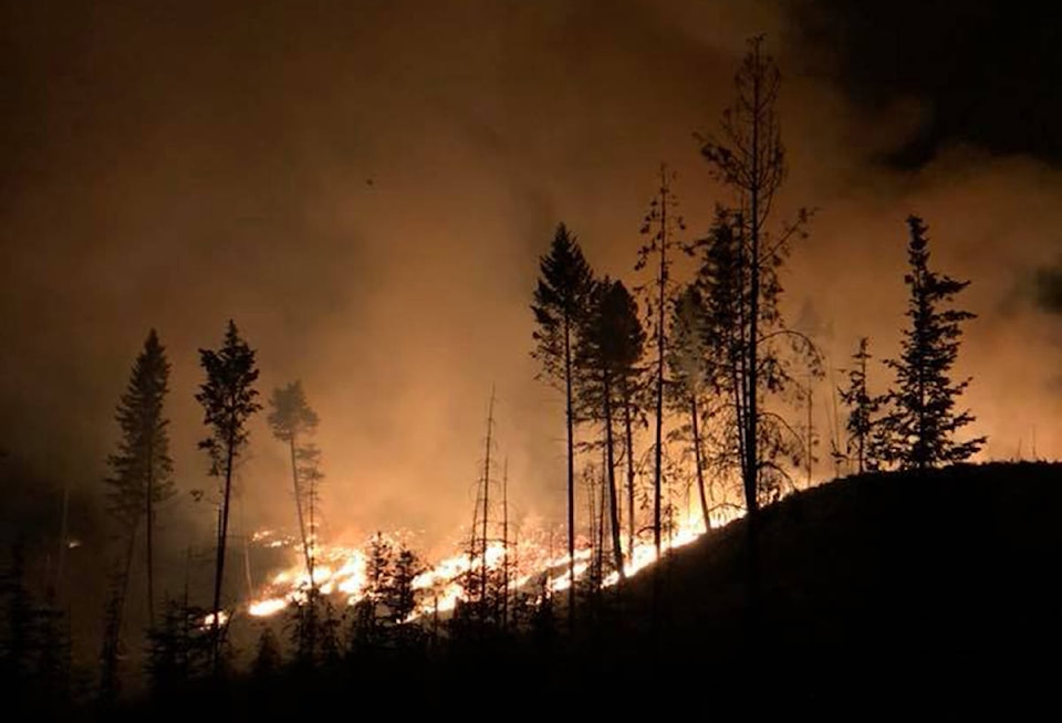
The two closest to Kimberley are Meachen Creek and the Lost Dog complex. BC Wildfire Service has been able to get a better picture of the Meachen Creek wildfire. It is now listed at 10,000 hectares, and this size may change as mapping accuracy increases with more flyovers.
The Meachen Creek fire is burning about t10 kilometres southwest of St. Mary’s Lake. BC Wildfire Service says the safety of St. Mary Valley residents remains the top priority for them, and the Service is developing “containment strategies” should the fire continue to burn down the drainage into terrain that is safer for crews to work on.
The evacuation alert issued by the Regional District of East Kootenay, in the St. Mary Lake area, from the western boundary of the City of Kimberley to the Redding Creek/St. Mary’s River convergence, including St. Mary Lake Road and Lakefront Road remains in effect.
The Lost Dog Complex, a collection of three fires burning 14 kilometres north of Kimberley, has a combined size of 425.5 hectares. There are currently 42 personnel, two helicopters and six pieces of heavy equipment on this fire. An evacuation alert for the Ta Ta Creek area, including an area west of the Kootenay River, from 1.5 kilometres south of Farstad Way Road to 2.5 kilometres north of Woods Corner.
The Regional District of East Kootenay, City of Kimberley and BC Wildfire Service will host a public information session on these two fires in Kimberley tonight, 6 p.m. at the Kimberley Conference Centre.
Elsewhere in the East Kootenay, the Coal Creek Forest Service Road wild fire burns about 12 kilometres east of Fernie and is estimated at 713 hectares.
There are 11 personnel on site, along with air support and heavy equipment. This fire is not currently threatening structures or communities but is highly visible.
The Sage Creek fire about 65 kilometres southeast of Fernie is at 1935 hectares. There are 102 personnel on site, supported by 12 helicopters, two airtankers and one piece of heavy equipment.
BC Wildfire Service is seeing some success on the Leach Creek wildfire, 21 kilometres southeast of Sparwood. It covers about 30 hectares and is 95 per cent machine-guarded and being held. An evacuation order for the community of Corbin and the Coal Mountain Mine property was first downgraded to an alert, lifted on Wednesday morning.
READ: Corbin evacuation order downgraded to alert
In the Invermere zone, the Cross River wildfire is about nine kilometres east of Highway 93 and 23 kilometres northeast of the Village of Radium and is at 2,723 hectares. There are 15 wildfire personnel actioning this fire, as well as heavy equipment. An evacuation order for the Cross River/Nipika Mountain Resort areas is in effect.
To report a wildfire or open burning violation, call 1 800 663-5555 toll-free or *5555 on a cellphone. For the latest information on current wildfire activity, burning restrictions, road closures and air quality advisories, visit: http://www.bcwildfire.ca