Area restrictions for access around the Akokli and Redding Creek fires are being reduced, but not removed entirely.
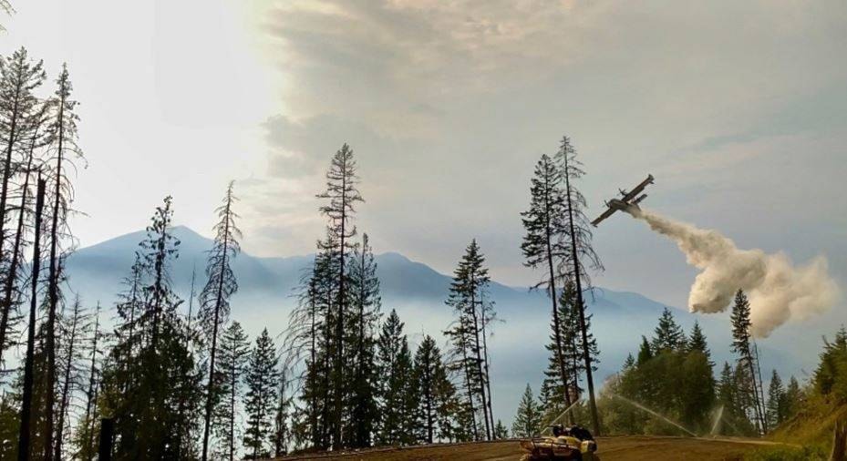
The BC Wildfire Service says the recent downturn in weather has bolstered weeks of hard work by firefighters, heavy equipment, and aerial resources. As a result of these efforts combined with the more favourable weather conditions over the last few days, fire activity has been reduced. Patrol continues along all constructed patrol lines, mop up is ongoing in Lockhart Park and attention will be shifted to rehabilitation planning. Portions of the fire in high elevation areas that pose no threat to nearby communities remain unsuppressed and contained by natural features.
Effective immediately the area restriction in the Akokli and Redding Creek areas will be reduced in size. While the size has been reduced, there is still a continued need to protect the public in areas where ongoing fire suppression activities are taking place.
This reduced area restriction is now in effect and will remain in effect until 12:00 noon (PDT) on October 15, 2021, or until rescinded. The order applies to Crown land within the geographic boundaries described below and outlined in the correlated map:
• Commencing at highway 3a Junction of Gray Creek Pass Forest Service Road (FSR), south to the junction of Ginol Creek.
• East following Ginol Creek to the height of land south of Mount Sherman, then north following the height of land Snowcrest Mountain.
• Northeast to the 24 km on the Gray Creek Pass FSR, continuing to the commencement point at Highway 3a.
• Note: Access to Upper Redding Creek FSR past the 24 km mark on Gray Creek FSR is prohibited.
• Note: Access along the Gray Creek FSR is permitted but entrance into the restricted area is prohibited.
Under this Order and section 11(2) of the Wildfire Act, a person must not remain in or enter the restricted area, unless the person:
1 first receives written authorization of an official designated for the purposes of the Wildfire Act, or
2 enters the area only in the course of:
a travelling to or from his or her residence, that is not under an evacuation order;
b using a highway as defined in the Transportation Act;
c travelling as a person acting in an official capacity as defined in s.56 of the Wildfire Act; or
d travelling for the purpose of supporting wildfire suppression or enforcement patrol activities.
Failure to comply with Section 11 restricted area requirements may result in a violation ticket of $1,150.
Road closures and area restrictions are subject to change depending on fire activity. For the most current information please visit the bans and restrictions section of the BC Wildfire website for the Southeast Fire Centre, or visit: http://ow.ly/k5jT50Fvlk3
The Southeast Fire Centre extends from the U.S. border in the south to Mica Dam in the north, and from the Okanagan Highlands and Monashee Mountains in the west, to the B.C.-Alberta border in the east.
To report a wildfire call 1 800 663-5555 toll-free or *5555 on a cellphone. For the latest information on current wildfire activity and burning restrictions visit: http://www.bcwildfire.ca or download the BC Wildfire App free for Apple and Android devices.
READ: Area restrictions increased on both Bill Nye Mountain and Dewar Creek fire
carolyn.grant@kimberleybulletin.com
Like us on Facebook and follow us on Twitter